🚦 Lines, lights, and the first tap
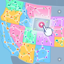
The map blinks awake like a quiet dashboard, and dots—some sleepy towns, some proud capitals—wait for a plan. You draw a simple road between two neighbors and watch the first little cars head out, polite as ants on a mission. Then a third city pops up at an awkward angle, a river cuts across your neat intention, and the camera leans in as if to whisper, now what. State Connect: Traffic Control is a Strategy Puzzle Game about sketching order on a living map. One line becomes two, two become a network, and somewhere between caution and curiosity, traffic begins to sing.
🧠 Map-reading for restless minds
Before you draw, you look. Where are the long hauls that need a spine. Which cities can share a ring and which demand a direct artery. A mountain says bridge or detour; a coastline says keep it simple or pay for shortcuts later. The puzzle is spatial and softly mathematical: reduce unnecessary intersections, avoid fragile single points of failure, and keep average travel time down so the economy hums. You are not coloring; you are editing distance.
🛣️ Roads that feel like promises
Every swipe is a decision you’ll live with for ten minutes or ten maps. Straight lines are fast but inflexible; curves steal seconds but dodge bottlenecks with grace. T-junctions are cheap, roundabouts are diplomatic, and overpasses are the sort of investment future-you will thank you for. A good link feels like a promise you can keep—clear lanes, clean merges, no drama at rush hour. A bad link looks fine at noon and turns petty at five.
🚗 Traffic has opinions
Vehicles aren’t just particles; they have habits. Commuters pile into downtown at the same beats, trucks lumber along trunk roads and clog if you underbuild, and ambulances—yes, those—want priority paths that glide past your mess. Left turns breed tiny rebellions; four-way crosses demand choreography. Watch a jam form once and you’ll trace the blame like a detective: that one 90-degree corner, that merge without a slip lane, that bridge you swore you could postpone. Fixes are surgical. Nudge a node, add a bypass, cut a feeder, and the knot exhales.
⚙️ Upgrades, budgets, and tiny miracles
The toolbox grows as the map widens. Extra lanes turn narrow straws into respectable highways. Timed lights smooth waves of cars like a DJ with taste. Ferries stitch islands into the plan with a charming chug, while tunnels turn mountains into rumors. Toll gates pull double duty: fund expansions and politely reduce load on a route that was getting too popular for its own good. Budgets matter, though, and every splurge is a trade: a new bridge now, or save for the roundabout that erases three future headaches. The magic is how often a single, well-placed upgrade makes five problems vanish like a polite ghost.
⏱️ Rush hour and the calm within
Scenarios ramp from cozy to chaotic. Timers tick, quotas rise, and special events drop a celebrity convoy onto your busiest boulevard just to test your manners. Panic is tempting, but the trick is calm iteration: pause, trace paths with your eyes, adjust one thing, watch. When you nail it, something lovely happens—the cars stop honking in your head, the lights pulse in rhythm, and the whole city feels like it chose teamwork.
🧭 Micro-strats disguised as common sense
Think in rings, not lines. Feed big hubs from multiple directions so a single spill doesn’t drown your day. Keep long-haul highways external and let locals dance inside; mixing them is how you invent gridlock. Favor right-hand merges (or left, if the map says so) so turns flow with traffic, not against it. Use short service roads to peel driveways off main arteries. And if a corridor keeps misbehaving, remove one intersection instead of adding three devices—sometimes subtraction is the smartest tool in the kit. None of this feels like a lecture when it works; it feels like the map saying thank you.
🌎 Maps with mood swings
Each region has an accent. Prairie states love sweeping arterials and reward big loops that tuck towns into tidy petals. Mountain belts insist on zigzags, switchbacks, and tunnels that turn minutes into magic. Coastal chains prefer ferries and causeways, inviting elegant half-moons that frame the sea. Desert grids look generous until dust storms push traffic off certain lanes and you learn to draft redundancy into every plan. Night modes add glow and rhythm, while rain reveals which corners were too ambitious for their own good.
🎧 The sound of smooth flow
Headphones wrap the game in a soft hum of engines and tiny blinks from signals that sync with your breathing. A gentle chime greets a new connection, a deeper tone celebrates a network milestone, and a low warning purrs when pressure builds somewhere you aren’t looking. The mix never yells; it nudges. Even muted, animation carries cues: brake lights ripple through queues like a heartbeat, and you can read where to open the artery without a single decibel.
😅 Mistakes you’ll laugh about
You will route two major highways through a single sleepy roundabout because it looked cute. You will add a bridge that shortens one trip and lengthens five others with cheerful malice. You will forget a ferry timetable and strand half a county on a pier while the other half enjoys a traffic-free utopia. The restart is quick, the lessons are sticky, and your next design will casually avoid last run’s hubris without you needing to brag about it. You’ll still brag.
📈 Progress that feels like ownership
Stars unlock new rulesets: limited intersections, eco budgets, weather caps, even challenges that grade your average travel time instead of raw throughput. Medals pop for clean feats—no jams at rush hour, zero stalled intersections across a full week, all capitals linked in under two minutes—and they look great on the results screen. But the real progress is internal. You start thinking two junctions ahead. You see a three-road knot and imagine a single roundabout with perfect exits, and then you draw it and it just works.
🪄 Comfort, clarity, and options
Assists keep the door open. Color-blind-friendly palettes distinguish routes and priorities with icon overlays. Haptic ticks confirm intersections without noise. Snap-to-grid can be softened for curvy artists or sharpened for engineers who dream in right angles. Undo is generous, because great networks are edited into existence. You can chase hard targets or set your own cozy pace—either way, the city cooperates when you’re kind to it.
🚀 Why one more network is always a good idea
Because clarity is addictive. Because a single road in the right place can unstick a map the way the right word unknots a sentence. Because the cars aren’t enemies; they are evidence that your plan is working. Because improvement is visible in the shape of your lines, the color of your heat map, and the silence of intersections that used to complain. Most of all, because it’s satisfying to turn geography into choreography and watch thousands of tiny commutes play out like applause you can read.
🏁 Final green light before the next connection
Breathe in, eyes up, grid on if you like. Draw the spine, loop the ring, keep long-haul lanes tidy, and give neighborhoods graceful exits. Add one perfect bypass instead of three noisy fixes, place lights that talk to each other, and save a bridge for when the river starts arguing. When rush hour hits and the city glides instead of groans, sit back for a beat and enjoy the glow. Then add the next state, extend the network, and let the traffic prove you right on Kiz10. Your cleanest map is one smart connection away.